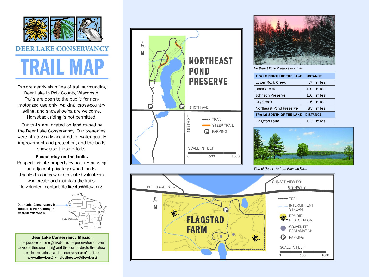
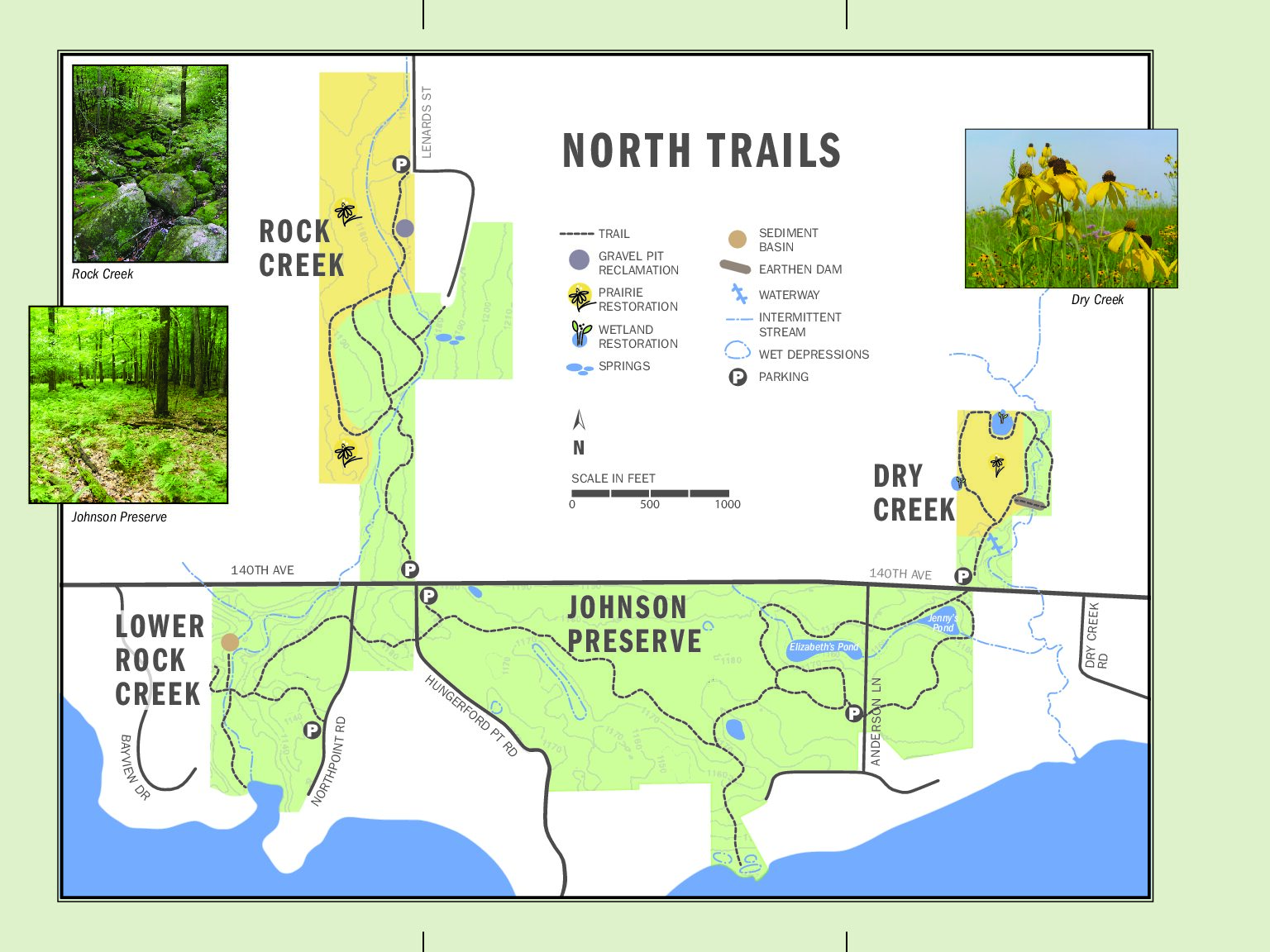
You can access Deer Lake Conservancy trails at parking areas in several locations. Enter parking area from Highway 8 to visit the Flagstad Farm. From 140th Avenue you can access Dry Creek Trails and Upper Rock Creek Trails. The Johnson Preserve parking areas are along Anderson Lane and Hungerford Point. Lower Rock Creek parking is available along Northpoint Road. Most trails on the north side of the lake are connected. There is a small parking area for the Watershed 1 Pond Preserve trails located on the north side of 140th Ave. across from 167th Street.


